
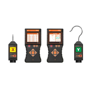
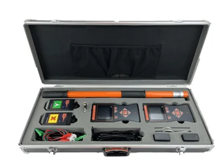
S390 – Wireless Phase Comparator (GPS Timing)

  • Satellite time synchronization for remote phase comparison

  • Standard wireless phasing up to 160 m in an open area

  • Phasing conductor voltage range: AC 1 V to 550 kV

  • Phase angle from 0° to 360° and frequency from 45 Hz to 75 Hz

  • Phasing without GNSS reception for over 30 minutes after synchronization

  • 2 handheld colour displays with signal and phase voice prompts

Product Description

The S390 is a wireless phase comparator that uses GPS/GNSS time synchronization to compare phase measurements at distant test points. Each test point has its own detector and handheld receiver; matching measurement timestamps allow phase comparison where the points are too far apart for a direct wireless link.

The system also provides standard wireless phasing up to 160 m in an open area. Phase angle, frequency, satellite status and stored records are shown on the colour displays. After successful synchronization, the time-synchronized mode can continue for more than 30 minutes without GNSS reception, provided the receivers remain powered on.

Technical FAQ

Does the 500 km figure describe the wireless link?
No. The manual describes more than 500 km between the two test points in GNSS time-synchronized phasing. The standard wireless distance is up to 160 m in an open area; a detector remains linked to its local receiver during remote testing.
Can it work without a satellite signal at the test location?
GNSS Time-Synchronized Mode requires successful outdoor synchronization first. The manual specifies more than 30 minutes of continued phasing without GNSS reception and instructs users not to power-cycle the receivers. GNSS PPS Precision Mode requires stable GNSS reception.
What is satellite timing used for?
Satellite timing synchronizes the receivers so that phase angles from the two test points can be compared at matching timestamps. This is the timing function used for remote phase comparison.
How are results from two locations compared?
The current manual specifies readings recorded at the same timestamp. For locations without GNSS or phone reception, both receivers can store measurements and the corresponding records can be compared after the test.